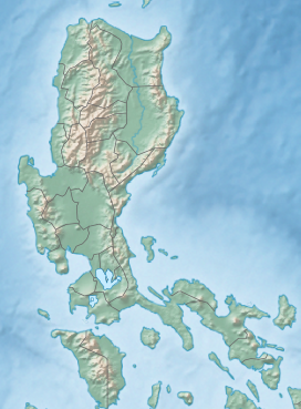
Back جبل مونت سامات ARZ Mount Samat CEB Samat (Berg) German Monte Samat Spanish کوه سمات Persian Սամաթ լեռ Armenian Bantay Samat ILO Mount Samat LLD Monte Samat Portuguese
| Mount Samat | |
|---|---|
 Mount Samat remote view | |
| Highest point | |
| Elevation | 560 m (1,840 ft)[1] |
| Prominence | 218 m (715 ft) |
| Parent peak | Mount Mariveles |
| Coordinates | 14°36′15.4″N 120°30′27.3″E / 14.604278°N 120.507583°E |
| Geography | |
| Location | Luzon |
| Country | Philippines |
| Region | Central Luzon |
| Province | Bataan |
| Municipality | Pilar |
| Parent range | Zambales Mountains |
| Geology | |
| Mountain type | Extinct volcano |
| Volcanic arc/belt | Western Bataan Lineament |
| Last eruption | Unknown |
| Climbing | |
| Easiest route | Mt. Samat Road[1] |
Mount Samat (Tagalog pronunciation: [samat]) is a mountain in the town of Pilar, Bataan, Philippines. Located near its summit is the Mount Samat National Shrine, a national shrine dedicated to the fallen Filipino and American fallen during World War II.
- ^ a b "Mount Samat, Cantral Luzon, Philippines". Google Maps. Retrieved on June 8, 2012.

